NASA sees formation of Tropical Storm Frances near Darwin

Tropical Storm Frances has formed in the Beagle Gulf, east of the Timor Sea near Darwin, Australia, and NASA's Aqua satellite captured a clear image of the storm.
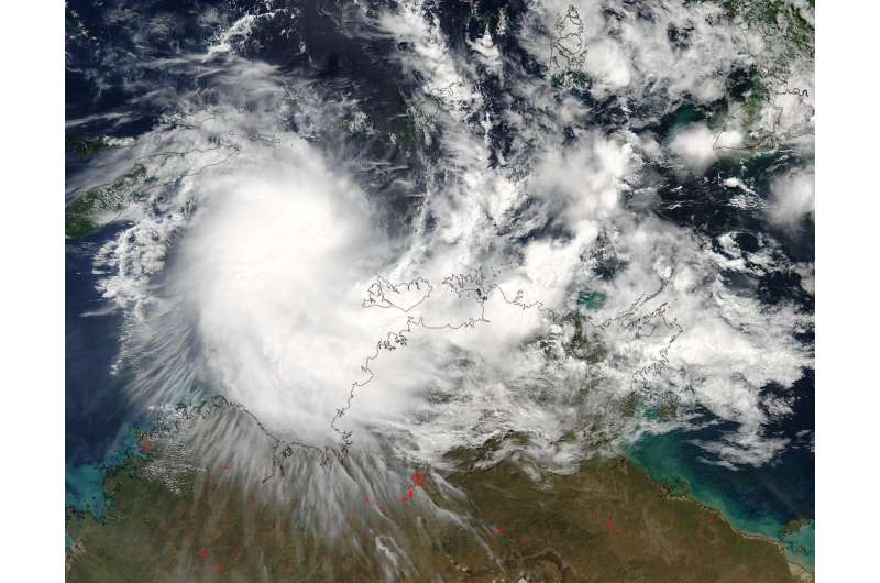
On April 27 at 04:50 UTC (12:50 a.m. EDT), the Moderate Resolution Imaging Spectroradiometer or MODIS instrument aboard NASA's Aqua satellite captured a visible image of Tropical Cyclone Frances. Frances appeared somewhat elongated.
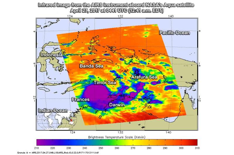
At 04:47 UTC (12:47 a.m. EDT), the Atmospheric Infrared Sounder or AIRS instrument aboard NASA's Aqua satellite gathered temperature data on Frances by viewing the storm in infrared light. The image showed thunderstorms with very cold cloud top temperatures near minus 60 degrees Fahrenheit / minus 53 degrees Celsius over the Tiwi Islands, Darwin and Garig Gunak Bariu National Park in the Northern Territory of Australia. Storms with cloud top temperatures have been found to produce heavy rain.
The Australian Bureau of Meteorology or ABM has posted a warning from Kuri Bay to Wyndham, not including Wyndham. In addition, ABM noted that tides between Kalumburu and Wyndham are likely to rise above normal high tide mark with very rough seas and flooding of low-lying coastal areas.
At 9:45 a.m. EST/U.S. or 11:15 p.m. ACST local time on Thursday April 27, Frances had maximum sustained winds near 53 mph /85 kilometers per hour with higher wind gusts. Frances was centered near 11.0 degrees south latitude and 128.3 degrees east longitude, about 146 miles/235 kilometers west of Pirlangimpi and 410 kilometers north northeast of Kalumburu. Frances was moving to the west-southwest at ~12 mph/19 kilometers per hour.

ABM said "Tropical Cyclone Frances is expected to intensify as it moves southwest through the Timor Sea tonight, possibly developing into a Category 2 system early on Friday, [April 28]. The cyclone is expected to remain over water as it heads towards the Indian Ocean, however If it takes a more southerly track peripheral gales may affect the north Kimberley coast later on Friday."
The Joint Typhoon Warning Center noted that as Frances tracks to the west vertical wind shear is forecast to increase and the storm may dissipate in three days by April 30.
For updated forecasts, visit: http://www.bom.gov.au/.
Provided by NASA's Goddard Space Flight Center


